
Texas & Midcontinent US Geological Edge Set
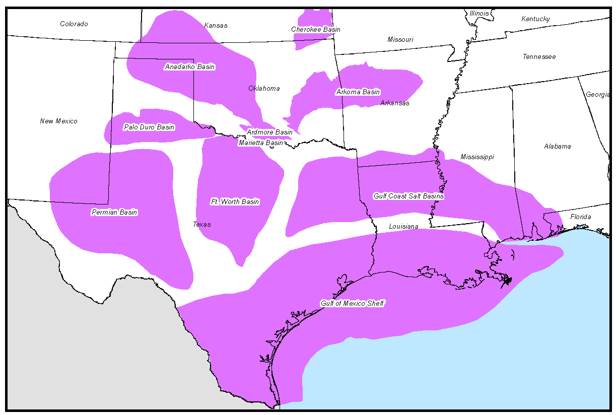
GeoEdges Inc. provides detailed and accurate subsurface geology at your fingertips in ArcGIS, GeoGraphix, Petra and all other ESRI Shapefile compatible mapping applications. Includes geological edges for Texas, Oklahoma, Kansas, SE New Mexico, Arkansas and Louisiana; mapping provided in the Anadarko, Arkoma, Fort Worth, Ardmore, Permian, Forest City, Maverick, and East Texas-Louisiana Salt Basins. Includes field outlines, structural features, outcrops, facies and reservoir trends, structure and isopach maps, shale gas trends and other resource plays
2024 Pricing
Annual License Subscription
The Texas and Midcontinent Geological Edge Set is available to subscribing companies on an annual license basis (per company, based on daily production):
>100,000 BOE/d USD $19,000 per year
<100,000 BOE/d USD $17,100 per year (discounted 10%)
<60,000 BOE/d USD $15,200 per year (discounted 20%)
<20,000 BOE/d USD $12,350 per year (discounted 35%)
<10,000 BOE/d USD $9,500 per year (discounted 50%)
<2,000 BOE/d USD $6,650 per year (discounted 65%)Note 1: for gas production please use a 6:1 conversion to BOE (1 BOE = 6 mcf)
Note 2: A service company's annual license fee will be based on the revenue of the company and not on production
Note 3: North American Shales is discounted 15% for each other set that a company licenses (due to geographic overlap)
LICENSE FEE INCLUDES:
Full set of ESRI Shapefiles compatible with most mapping applications (Petra, GeoGraphix, etc.)
Petra Thematic Mapper Projects, GeoGraphix Projects, ArcGIS Projects
Hard copy prints of key maps
Regional cross-sections in PDF format
Digital user's manual
Access to ongoing updates and additions to mapping, technical support
Coverage for Texas, Oklahoma, Arkansas, Louisiana, and parts of New Mexico, Colorado, Kansas, and Mississippi
LIST OF GEOLOGICAL FEATURES PROVIDED:
General Features: Basin, Permian Sub-basins, Ouachita Front, Faults, Fault Zones, Salt Basins, Salt Structures, States, counties, TR grid
Bedrock Geology: Arkansas, Kansas, Louisiana, Oklahoma, Texas
Tertiary: Frio, Wilcox
Cretaceous: Buda Structure, Eagle Ford, Tuscaloosa
Jurassic: Bossier, Haynesville
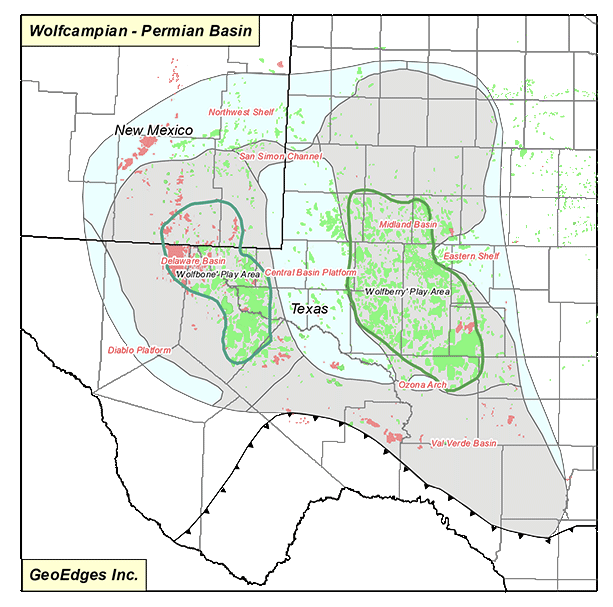
Permian: Abo, Wolfcampian, Guadalupian, Leonardian, Spraberry
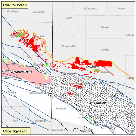
Pennsylvanian: Granite Wash, Horseshoe Atoll, Red Fork, Morrow paleogeography, Morrow valleys
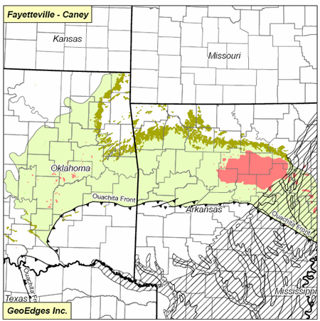
Mississippian: Barnett, Fayetteville-Caney, Mississippian Subcrops (Osage, Meramec, Chester, sycamore), Mississippian chat, Mississippian Horizontal Play Areas
Devonian: Woodford
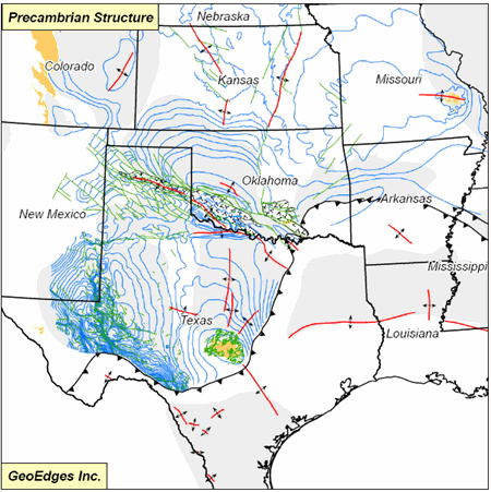
Precambrian: Precambrian Structure, Basement Faults
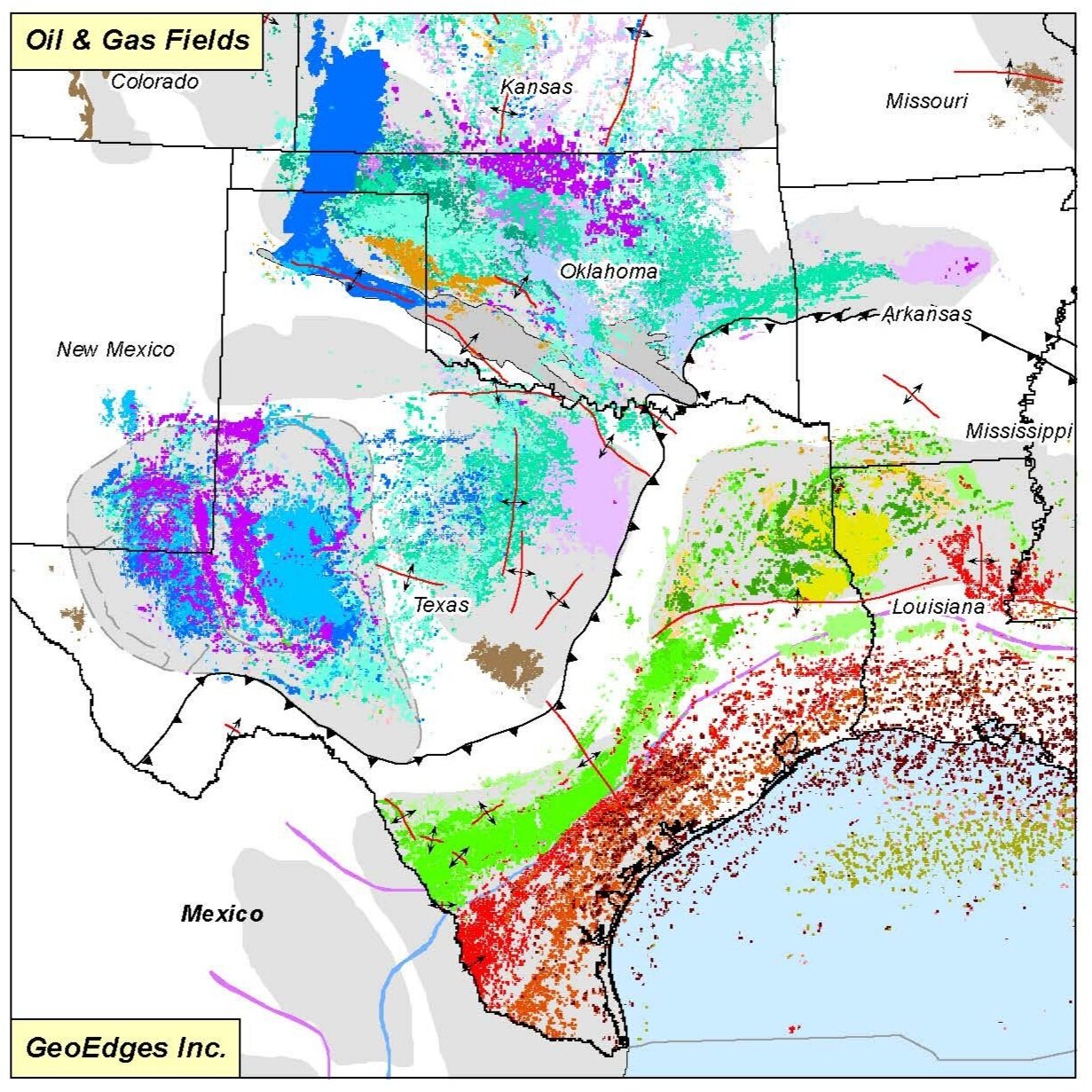
Fields: Barnett, Cretaceous, Devonian, Eagle Ford, Fayetteville-Caney, Granite Wash, Haynesville, Jurassic, Mississippian Springer, Mississippian Chat, Mississippian, Ordovician, Penn Desmoines-Atoka, Penn Virgil-Missouri, Penn Morrow, Perm Guadalupian, Perm Leonardian, Perm Wolfcampian, Silurian, Tertiary, Woodford