
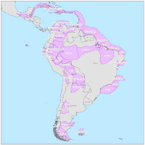
South America Geological Edge Set
GeoEdges Inc. provides detailed and accurate subsurface geology at your fingertips in ArcGIS, Petrosys, GeoGraphix, Petra and all other ESRI Shapefile compatible mapping applications. Includes geological edges for Argentina, Bolivia, Brazil, Chile, Colombia, Ecuador, French Guyana, Guyana, Paraguay, Peru, Trinidad, Venezuela, and more. Includes field outlines, structural features, facies and reservoir trends, outcrops, license blocks, transportation infrastructure, structure and isopach maps, shale gas maturity and distribution.
2024 Pricing
Annual License Subscription
The South America Geological Edge Set is available to subscribing companies on an annual license basis (per company, based on daily worldwide production):
>100,000 BOE/d USD $19,000 per year
<100,000 BOE/d USD $17,100 per year (discounted 10%)
<60,000 BOE/d USD $15,200 per year (discounted 20%)
<20,000 BOE/d USD $12,350 per year (discounted 35%)
<10,000 BOE/d USD $9,500 per year (discounted 50%)
<2,000 BOE/d USD $6,650 per year (discounted 65%)Note 1: for gas production please use a 6:1 conversion to BOE (1 BOE = 6 mcf)
Note 2: A service company's annual license fee will be based on the revenue of the company and not on production
Note 3: North American Shales is discounted 15% for each other set that a company licenses (due to geographic overlap)
LICENSE FEE INCLUDES:
Full set of ESRI SHAPE files for import into Petra, GeoGraphix, Arc GIS and other programs
Petra Thematic Mapper projects, GeoGraphix files, ArcView maps
Hard copy prints of key maps
User's manual in digital format
Updates and additions to mapping
Full technical support
LIST OF GEOLOGICAL FEATURES PROVIDED:
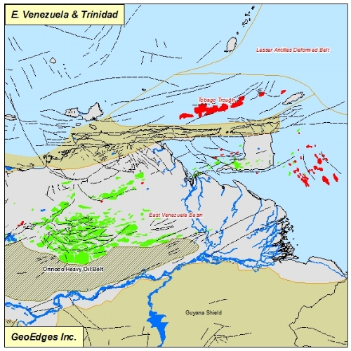
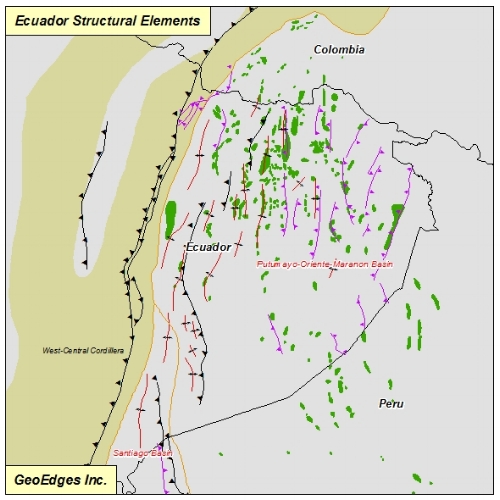
General: Producing Basins, Arches & Anticlines, Synclines & Basin Axes, Cordillera, Shield, Thrusts, Faults, Strike-Slip Faults, Orinoco Heavy Oil Belt, Rivers, Water Bodies, Pipelines, Roads, Railroads, Urban Areas, Countries, Provinces, Topography, Bathymetry, Lat-Long Grid, etc.
Bedrock Geology: Quaternary, Tertiary, Cretaceous, Jurassic, Triassic, Permian, Carboniferous, Paleozoic,
Volcanics, Metamorphics, Precambrian
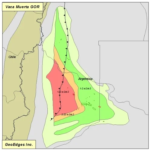
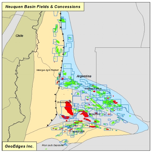
O & G Fields: S America O & G Fields, Vaca Muerta Fields
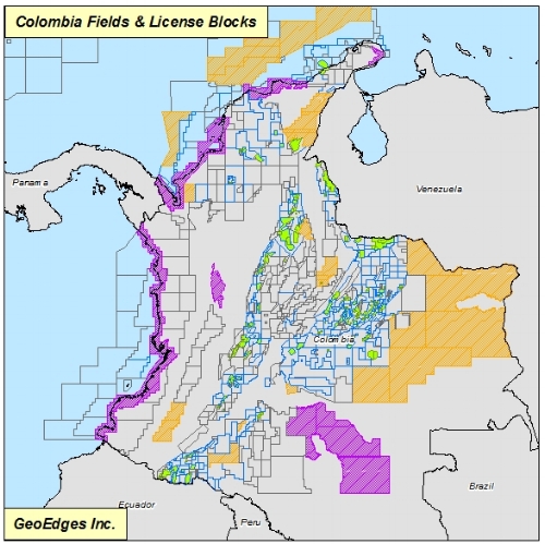
License Blocks: Argentina, Brazil, Colombia, Peru Exploration & Production License Blocks
Shale Plays: Vaca Muerta, Los Monos, Cacheuta, D129, Barreirinha, Inoceramus, Los Molles, Ponta Grossa, Aguada Bandera, Yacoraite, Jandiatuba. Includes: Shale Limits, Isopachs, Oil Windows,
Wet Gas - Condensate Windows, Dry Gas Windows, GOR, Vitrinite Reflectance
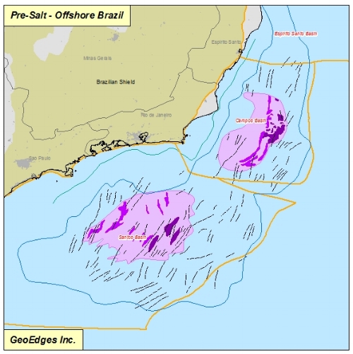
Pre-Salt: Salt Limit, Sag Basin Outline, Deep Salt Basin, Salt Structures, Cabo Frio Detachment Gap, Microbial Platforms & Buildups, Salt Domains, Salt Frontal Edge, Area of Poor Salt Imaging
Wells (where available): Argentina, Peru