
Western USA & Williston Basin Geological Edge Set
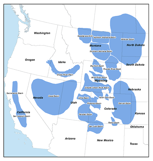
GeoEdges Inc. provides detailed and accurate subsurface geology at your fingertips in ArcGIS, GeoGraphix, Petra, AccuMap, GeoScout and all other mapping applications. Geological edges are provided for Montana, North Dakota, Wyoming, Utah and Colorado. Coverage area includes the entire Williston Basin (including Canada), Sweetgrass Arch, central and southern Montana, Powder River, Bighorn, Wind River, Green River, Southern Wyoming, Denver, Piceance, Uinta, San Juan and Paradox Basins.
2026 Pricing
Annual License Subscription
The Northern US Rockies & Williston Basin Geological Edge Set is available to subscribing companies on an annual license basis (per company, based on daily production):
>100,000 BOE/d USD $21,000 per year
<100,000 BOE/d USD $18,900 per year (discounted 10%)
<60,000 BOE/d USD $16,800 per year (discounted 20%)
<20,000 BOE/d USD $13,650 per year (discounted 35%)
<10,000 BOE/d USD $10,500 per year (discounted 50%)
<2,000 BOE/d USD $7,350 per year (discounted 65%)Note 1: for gas production please use a 6:1 conversion to BOE (1 BOE = 6 mcf)
Note 2: A service company's annual license fee will be based on the revenue of the company and not on production
Note 3: North American Shales is discounted 15% for each other set that a company licenses (due to geographic overlap)
LICENSE FEE INCLUDES:
Full set of ESRI Shape files compatible with most mapping applications (Petra, GeoGraphix, etc.)
Full set of digital edges for AccuMap (provided as Map Features and as Map/Annotation files)
Petra Thematic Mapper Projects, GeoGraphix Projects, ArcGIS Projects
Hard copy prints of key maps
20 regional cross-sections in PDF format
Digital user's manual
Access to ongoing updates and additions to mapping, technical support
Coverage for Montana, North Dakota, Wyoming, Utah, Colorado, and the Canadian portion of the Williston Basin
LIST OF GEOLOGICAL FEATURES PROVIDED:
General: Precambrian Outcrop, Intrusions, Volcanics, Deformation Front, Faults, Anticlines, Synclines, Basin Axis, WY/UT Thrust Belt
Tertiary: Ft. Union CBM Fairway
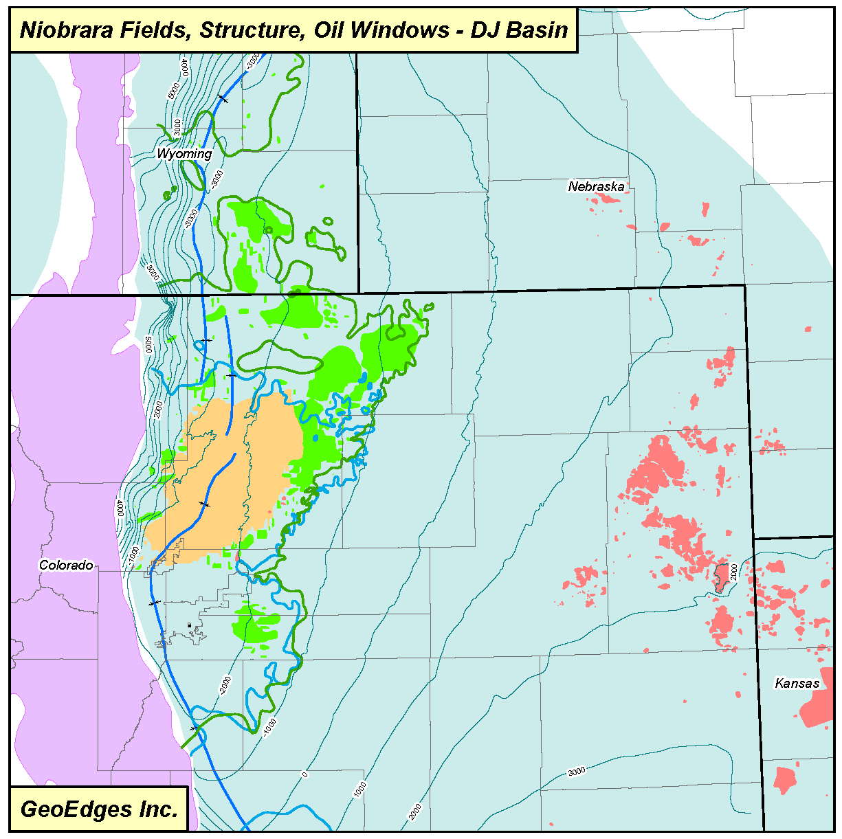
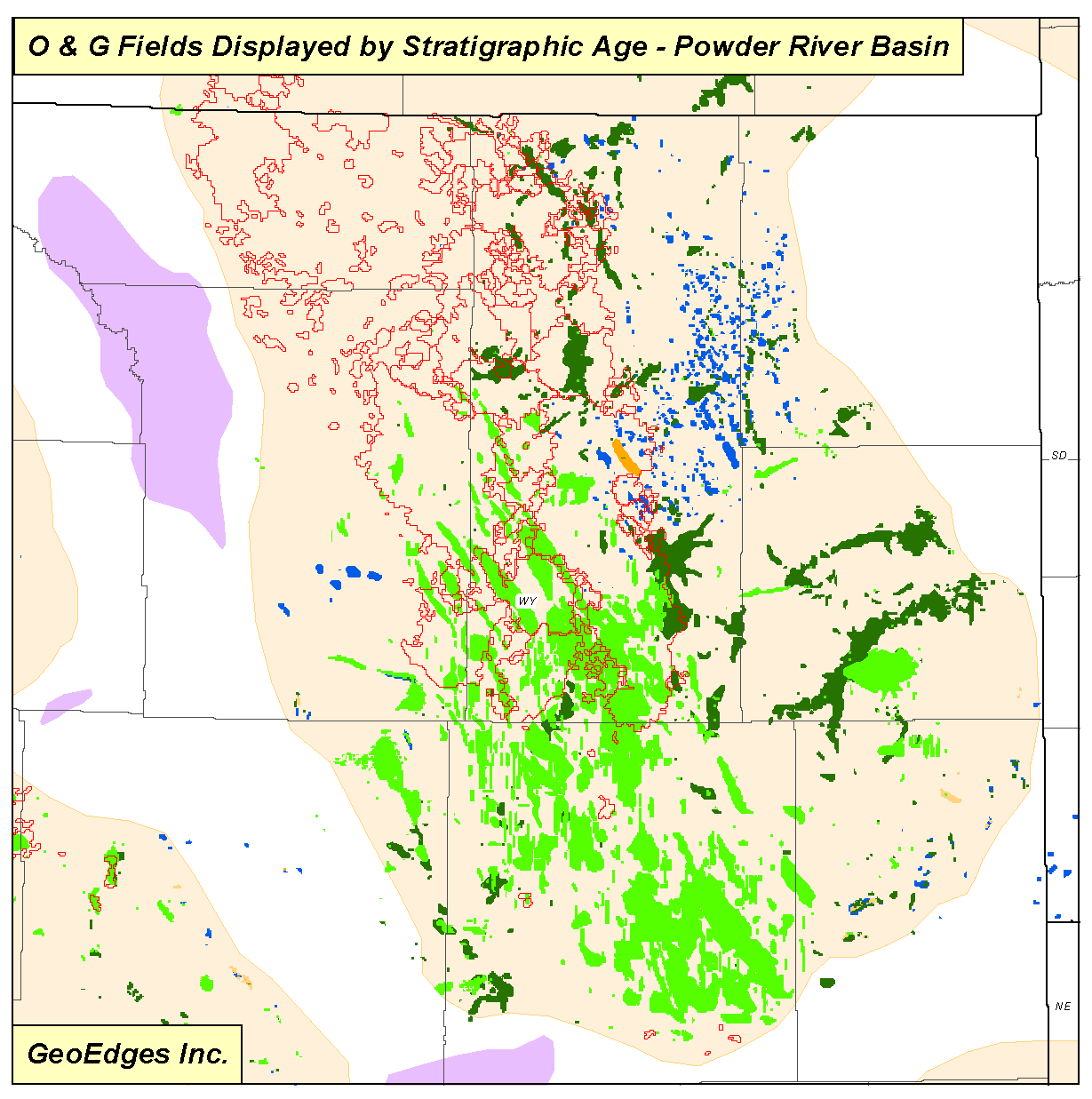
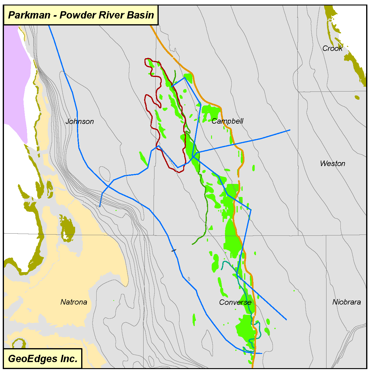
Cretaceous: Cutbank Valley Edge, Moulton Sandstone, Glauconitic (U. Sunburst) Channels, Muddy Fm., Dakota Fm., Skull Ck., D Sand, J Sand, Shannon-Eagle, Sussex, Parkman-Judith River, Teapot, Tecla, Frontier, Almond, Lewis, Niobrara, Mesaverde Shorelines, Cretaceous Formational Limits
Jurassic: Jurassic Subcrop Permian: Phosphoria peritidal fairway
Permian: Phosphoria peritidal fairway
Pennsylvanian: Tyler Subcrop, Tyler Sandstone Fairway, Paradox Salt Anticlines, Paradox Clastics, Minnelusa, Ismay Mounds, Desert Creek Mounds
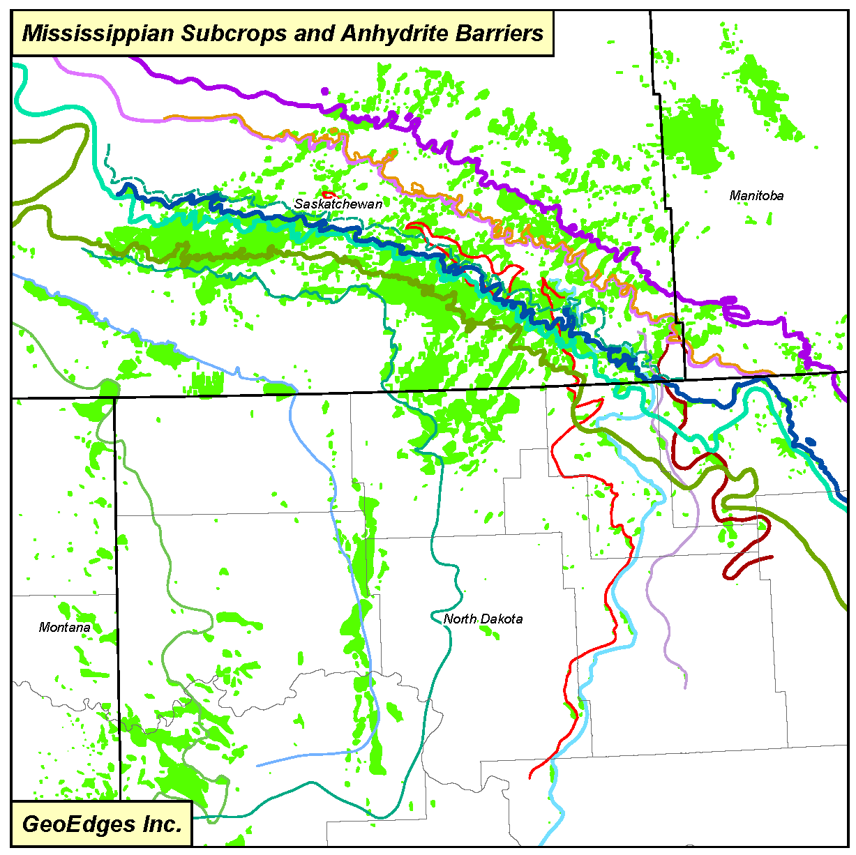
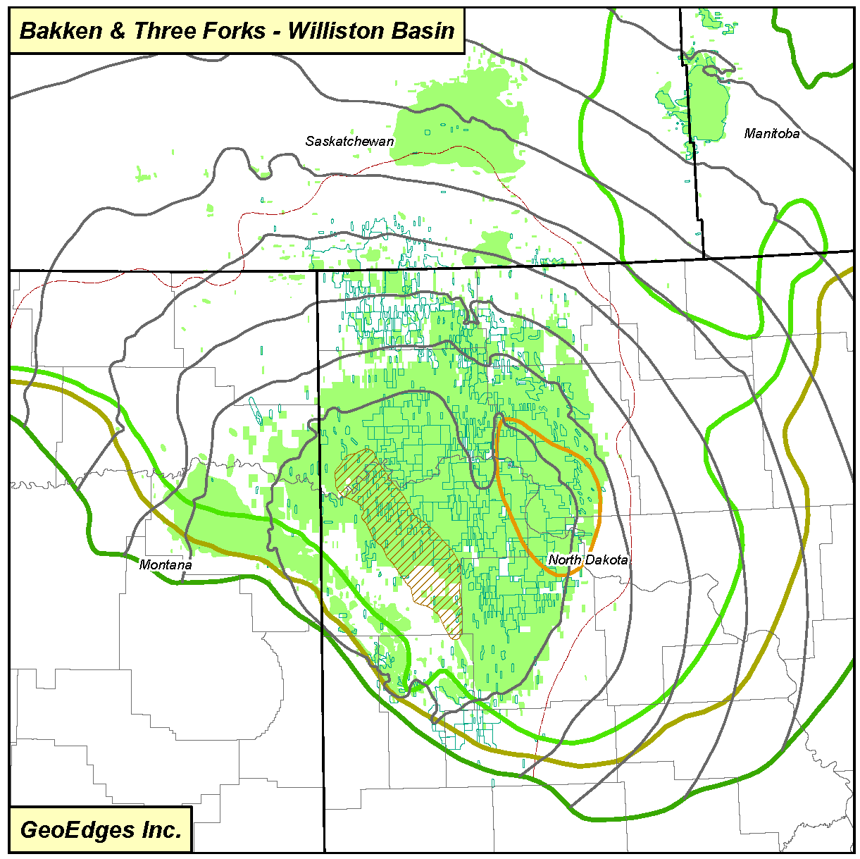
Mississippian: Kibbey, Poplar, Ratcliffe, Midale, Tilston, Lodgepole, Bakken, Middle Bakken, Lower Bakken subcrop edges; Heath Shale; Bakken Limit of Hydrocarbon Maturity; Bakken Structure, Flat Lake, Berentson, Rival-Nesson, Bluell, Sherwood, Glenburn, Mohall Anhydrite Barriers
Devonian: Devonian Subcrop, Dawson Bay Subcrop, Duperow Subcrop, Birdbear Subcrop, Prairie Evaporite Salt Edge, Three Forks Subcrop, Sanish Mbr. Subcrop, Sanish Sst. Subcrop, Sinclair Mbr. Subcrop
Pre-Devonian: Red River Subcrop, Stony Mountain Subcrop, Silurian Outcrop
Fields: Ordovician, Silurian, Devonian, Mississippian, Pennsylvanian, Permian, Triassic, Jurassic, Lower Cretaceous, Upper Cretaceous, Tertiary